In the earlier Neolithic, the preferred system for disposal of the dead was by anonymous and communal burial in great long barrows. In the late Neolithic and Early Bronze Age, however,there was a profound shift in the form of funerary monuments. Smaller, circular monuments of simpler construction came to be favoured, usually intended for a single individual who was often accompanied in death by personal possessions.
It appears that only a proportion of the population were interred in this fashion, perhaps those of high-status within their communities. This development in burial practices presumably mirrors significant changes in both religious and social beliefs, as an increasingly personalised and hierarchical society developed, in which individual leadership became more important.
Frances Lynch has noted that north-east Wales in the Bronze Age became ‘far more clearly integrated…into the culture of neighbouring regions to the west and north-east, sharing with them traditions of burial and ceremony…’ [i] Lynch has also observed that the region played a vital role in the major social and economic developments of the period. The composition and design of axes found in several hoards in the area, for example Moelfre Uchaf and Acton Park, suggest that local bronzesmiths were in the vanguard of metal-working technology in the Early and Middle Bronze Age, producing innovative designs and metal of exceptional quality; the success of this local industry brought the region the substantial wealth suggested by finds such as the spectacular Mold Gold Cape, the largest piece of goldwork from prehistoric Britain, which was found beneath a round barrow close to the River Alyn near Mold, only 14.7 km north-west of Caer Alyn. Although this metal-working industry declined in the Middle Bronze Age, the area was still apparently serving as a link for the exchange of Irish and European decorative bronze and gold metalwork into the Later Bronze Age. [ii] The region’s continuing wealth and long-distance trading connections is evidenced in finds such as the Middle and Late Bronze Age hoards of gold and bronze jewellery, tools and weapons found at Burton and Rossett, less than 5 km north-east of Caer Alyn. The Burton hoard was buried in the Alyn valley, and Adam Gwilt, from the National Museum and Gallery at Cardiff, has speculated that the people who buried it ‘were making a religious statement, maybe…about an important communication route’. [iii]
Round barrows are by far the most common type of Bronze Age monument to survive in north-east Wales. [iv] The Bryn Alyn round barrow (NPRN 155640) is scheduled as a Bronze Age tumulus. However, it has not been excavated and has not always been considered to be of any archaeological value; in 1914 it was described by the Royal Commission on Ancient Monuments in Wales and Monmouthshire, as only ‘a slight elevation, which has every appearance of being natural….a long and narrow bank of earth which is certainly not the remains of a tumulus…’. [v] The mound is roughly circular, covered by turf, and measures approximately 21-22m in diameter. It is built into a rise in the surface of the field to the north and north-east, so whilst it stands approximately 2m high at its southern end, it measures less than a metre at its northern end. The mound has also been disturbed by ploughing. There are depressions in the ground to the east of the mound, which may have been caused by the removal of soil to build the barrow, or perhaps sand and gravel extraction, which we know has occurred in other fields close to the barrow.
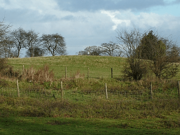
Fig 1. The Bryn Alyn barrow viewed from the south-west.

Fig 2. The Bryn Alyn barrow viewed from the west.
Although the mound appears not to have a surrounding ditch, a resistivity survey undertaken in 2011 found evidence for a possible shallow ditch, in the form of a circular low resistance feature surrounding the mound. [vi]
The only record of any investigation of the mound dates from 1929, when Canon Ellis Davies noted that the then owner had sunk a hole 5 ft deep in the mound a few years earlier to support a vane, and had discovered nothing. [vii] However, this shaft was apparently not in the centre of the mound; as primary burials in round barrows tended to be placed centrally, the shaft may well have missed any such feature.
The Bryn Alyn barrow may contain only one individual, or several. Some barrows in the north or west of Britain were built to contain several people, perhaps buried at the same time, [viii] while others were constructed initially for a single person, but secondary burials were then sunk into and around the barrow subsequently. In north-east Wales a mixture of single burial monuments and barrows covering several burials have been found, suggesting that the old traditions of communal burial were slow to die out. [ix]
The Bryn Alyn mound today appears isolated, with no trace of any other Bronze Age or Neolithic monuments in its immediate vicinity. Many Bronze Age barrows in this region and elsewhere are found in clusters, and often close to other types of monuments, such as standing stones and ring ditches, and in some areas of the country, such as Avebury and Stonehenge, very large and complex ritual landscapes were formed. However, solitary tumuli are not uncommon, and it is not always possible to tell whether the archaeological distributions we see today are deliberate or accidental. Some monuments may have been constructed as individual entities, and their close proximity to others may have been coincidental, [x] or destruction by later generations may have left some monuments as the sole survivors of larger, deliberately constructed, sacred landscapes.
Bryn Alyn hillfort is 0.5 km to the south of the tumulus. It is believed the fort dates from the Iron Age; however, the promontory the fort sits on could have been used in the Neolithic or Bronze Age; several hillforts in north-east Wales have produced evidence of Bronze Age activity in their interiors or in close proximity, including Penycloddiau, Foel Fennli, Moel Arthur and Moel-y-Gaer, Rhosesmor.
The Tithe Map of 1843 shows that the old boundary of the field that the Bryn Alyn tumulus stood in is strangely shaped. At one point, the boundary appears to curve around the area the barrow stands in, although the tumulus is not recorded on the map. It may be that the boundary took such a contorted route because of the barrow and the remains of other features which are no longer evident in the landscape today. However, the name of the field – Barn Field and Smith Close – refers to buildings in the far northern corner of the field and provides no clues in this respect.

Fig 3. Drawing of Barn Field & Smith Close copied from the Tithe Map of 1843, with the approximate position of the Bryn Alyn barrow marked by a green circle.
The Bryn Alyn barrow sits approximately 79m above sea level, above the valley of the River Alyn. It is approximately 250m in from the edge of the present-day valley edge, making it impossible to see from the valley below. It may have been positioned above the river rather than in the valley so as to appear more prominent in the wider landscape. However, it is difficult today to gauge the mound’s visibility when it was constructed. It is smaller today than it was originally, as it has been subjected to ploughing or some other form of damage. Modern hedgerows and buildings obscure the view of the barrow from many angles. In the absence of an environmental survey of the area, we cannot tell how thickly wooded the Caer Alyn plateau was in the Bronze Age, but tree cover may have been much sparser than it is today, allowing for better views of the mound from farther afield.
The River Alyn was a territorial boundary in later centuries, and may have served as a tribal boundary in the Bronze Age. If this was the case, the barrow may have served as a marker, also delineating the boundary of the tribal territory. Excavation of some mounds has shown them to be devoid of burials and it appears they were built solely for the purpose of marking territories, or as a kind of political or tribal memorial. [xi] However, the barrow may have been both a grave and a tribal marker.
The presence of the barrow does not mean that there was a Bronze Age settlement on the Caer Alyn plateau itself. There is as yet no evidence of any Bronze Age houses or field systems at Caer Alyn, but a recent excavation close to the tumulus revealed a shallow clay-lined pit that contained several pieces of prehistoric ceramic, that have been identified as prehistoric, and possibly Bronze Age. [xii]

Fig 4. Some of the prehistoric ceramic found close to the Bryn Alyn barrow.
Round mounds have been constructed for millennia, not just for burial or as territorial markers, but also as meeting places for local courts, medieval archery butts, gibbet mounds, prospect mounds in formal gardens, bases for castles, windmills, or beacons, and more recently as Second World War decoy or training sites; many genuine Bronze Age barrows have also been reused by later generations for these purposes. [xiii] There is a possibility that the Bryn Alyn barrow did not originate as a Bronze Age burial mound, but there is as yet no evidence to suggest that it was built at a different period or for a different purpose, or how, if at all, it was used by later generations. We can be certain that the mound was not constructed for military activity in the Second World War, though, as it is first noted on the Ordnance Survey First Edition map of 1879. It seems unlikely that the mound was built as a viewing platform as there is no evidence that there were ever formal gardens on this part of the site.
It is only when an excavation of the Bryn Alyn barrow can be undertaken that any definite answers will be obtained; until then, we can only speculate as to the nature and origins of the mound, and its subsequent history.
[i] F. Lynch, ‘The Bronze Age’, in The Archaeology of Clwyd, ed. J. Manley, S. Grenter & F.Gale (Clwyd; Clwyd County Council, 1991), p. 65.
[ii] Lynch, ‘The Bronze Age’, pp. 76-78.
[iii] BBC News website. Retrieved in 2005 from http://news.bbc.co.uk/1/hi/wales/north_east/4289914.stm
[iv] Lynch, ‘The Bronze Age’, p. 70.
[v] Royal Commission on Ancient Monuments in Wales and Monmouthshire (Denbigh; HMSO,1914), p. 79.
[vi] Doughty, A., Brown, A. & Rogers, A., 2011. Caer Alyn Archaeological and Heritage Project, Geophysical Survey (Resistance) Tumulus Field: Interim Report (Caer Alyn Hill Fort).
[vii] Canon E. Davies, Prehistoric and Roman Remains of Denbighshire (Cardiff; William Lewis Ltd, 1929), p. 155.
[viii] F. Lynch, ‘The Later Neolithic and Earlier Bronze Age’, in Prehistoric Wales, ed. F. Lynch, S. Aldhouse-Green & J. L. Davies (Stroud; Sutton Publishing Ltd, 2000) p. 126.
[ix] Lynch, ‘The Bronze Age’, pp. 71-72.
[x] F. Lynch, ‘Prehistoric Funerary and Ritual Monuments in Flintshire and Wrexham’, Flintshire Historical Society Journal, Vol 36 (2003), p. 20.
[xi] Lynch, ‘The Later Neolithic and Earlier Bronze Age’, p. 127.
[xii] P. Blinkhorn, Pottery from Caer Alyn.
[xiii] M. Aston, Interpreting the Landscape, (Routledge; London, 1998), pp. 15-16.
